More than a report generator
Research, drafting, review, delivery, field work and the everyday work around a project, in one workspace your whole team shares.

Research and drafting
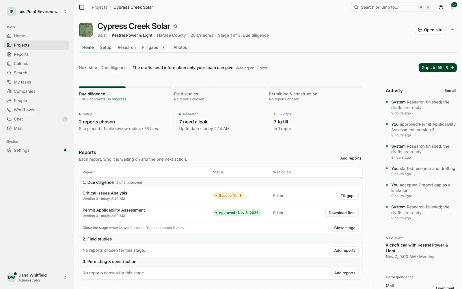
Pick the reports. The research and the first draft come back together.
Place the site once. Everything the chosen reports need is researched for the site and its study radius, and each draft comes back with its maps, tables, appendices and citations.
- Draw the boundary, upload a KML, KMZ, shapefile or GeoJSON, or pick parcels by address, number or owner.
- Every value names its source, and desktop data says it is mapped data.
- When project details change, the drafts that depend on them are marked for an update.
Fill gaps
Only what the record can’t say comes back to you.
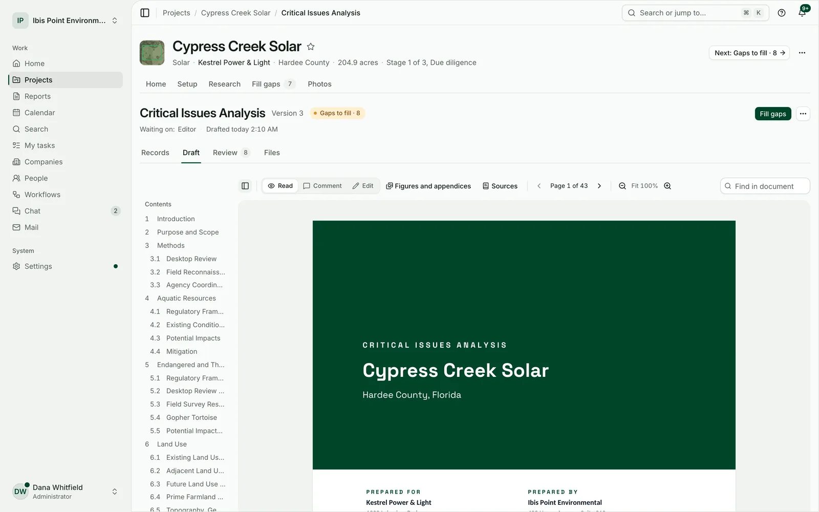
Fieldwork, surveys, restricted records and professional judgement are listed as plain questions, grouped by kind. Answer one, attach a file, or mark it not available, and the draft follows.
- Each item says what is needed and where it goes in the draft.
- A gap stays visible in the draft until someone answers it. Unknown is never written up as “no impact”.
- An item no one can answer is marked not available, with the reason, and the draft says so.
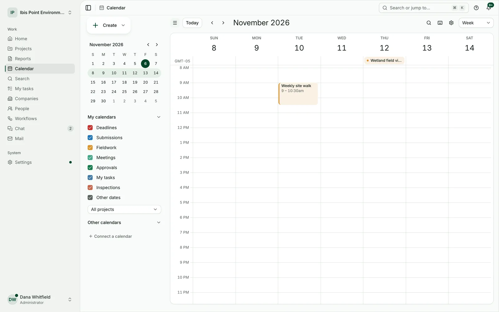
Review and approval
Read, edit, comment and approve in one place.
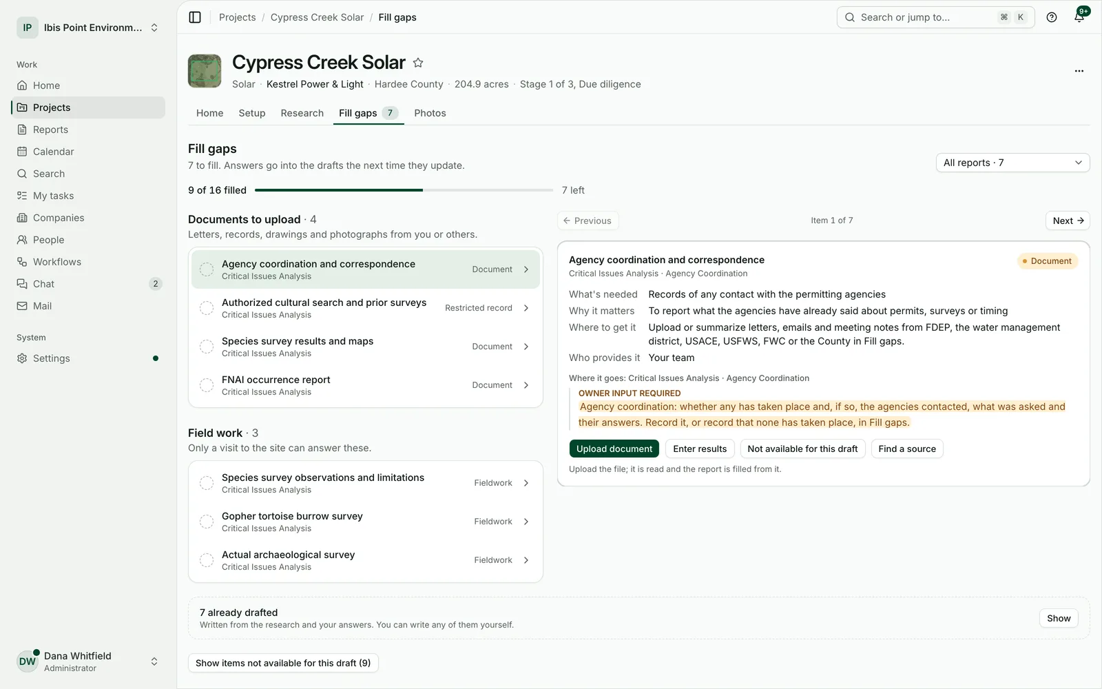
Change any paragraph or table cell and your wording carries into later versions. Ask a colleague to review, and see in one list what still stands between the draft and approval.
- Comments on any paragraph, with replies.
- Approval records who approved which version, and when.
- Approval is an internal step: your licensed professional still signs and issues the report.
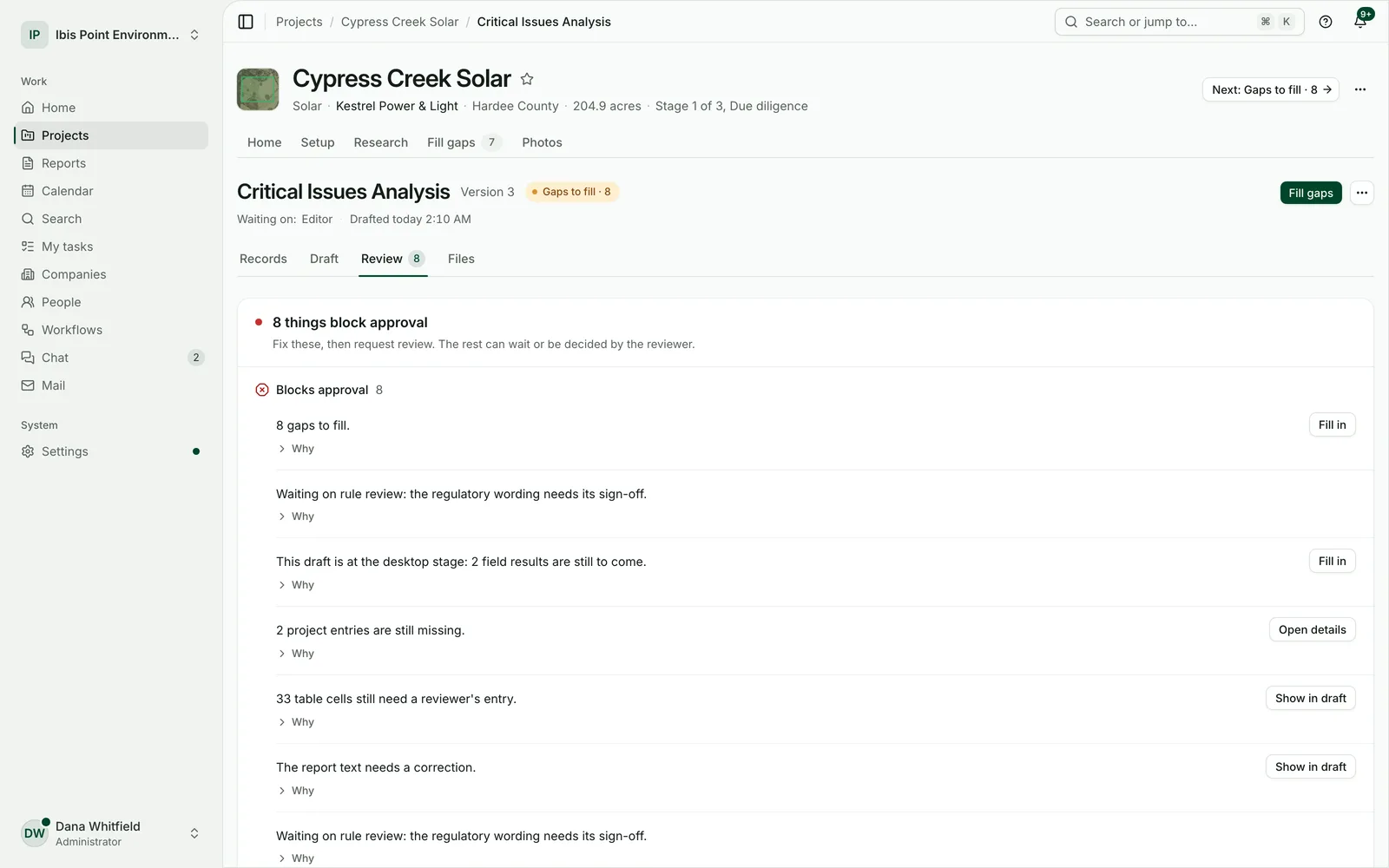
Client share links
Send the final files with a link, not an attachment.
Share a report’s files with a client through a link that works for as long as you choose, with a passcode if you want one. Email it from the project with your own templates.
- Choose which files the link holds.
- Turn a link off at any time.
- Mark a report as issued once it has gone out.
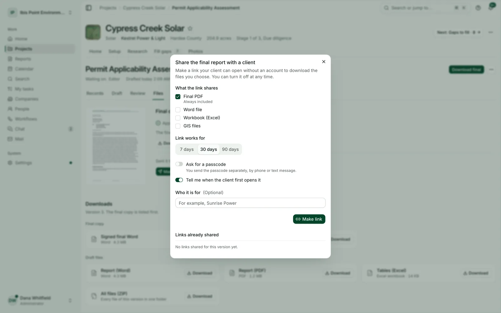
Search
Ask a question across maps, rules and your own documents.
Search answers in plain words, with the passage it came from, across the regulations your reports rely on and the files in your projects.
- Find a rule, a permit threshold or a paragraph in last year’s report.
- Jump straight to any project, report, company or person.
- Results stay inside your firm: other firms never see your files.
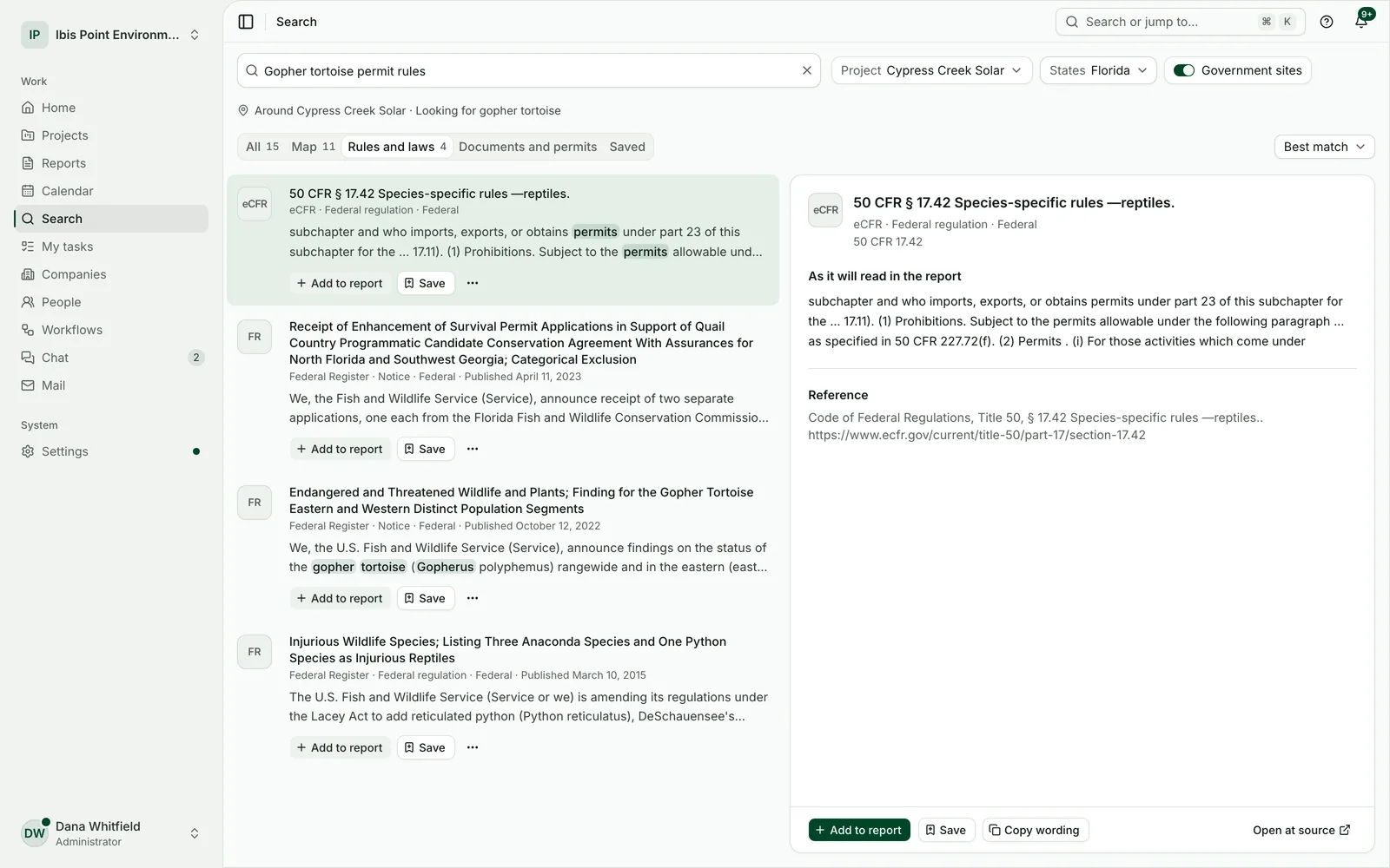
Calendar and mail
The project’s dates and emails next to its reports.
Site visits, deadlines and meetings sit on a calendar that syncs with Google Calendar and Outlook. Email the client from the project, from your own address, with your templates and signature.
- Repeating events and guests who answer from the email.
- Every email kept with the project it belongs to.
- Team chat by project, so the decisions stay with the work.
Field app
Photos, forms and inspections from the field, even offline.
Crews take located photographs, fill in the official forms and record inspections on a phone or tablet. Work done without a signal is kept on the device and sent when it is back online.
- A photo log with a map of where each picture was taken.
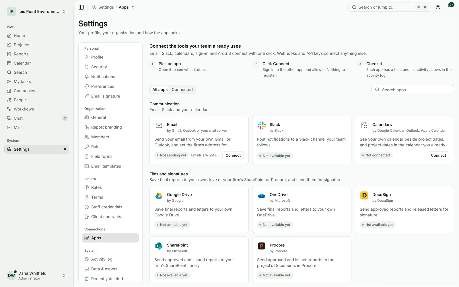
- USACE and Florida wetland forms, printable as a field packet.
- Stormwater and spill plan inspections with their follow-up items.
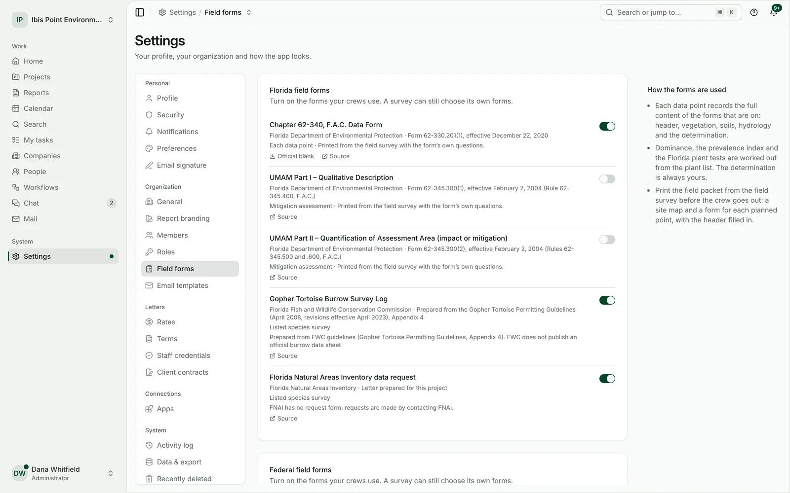
Lab imports
The laboratory’s file in, the results tables out.
Import the lab’s electronic results for a Phase II or a monitoring event. Each result is compared with the Florida cleanup target levels, and anything above them is called out for your geologist.
- A check before saving shows what the file holds and what needs a look.
- Results land in the report’s tables and figures.
- Your professional makes the decisions; nothing is concluded for them.
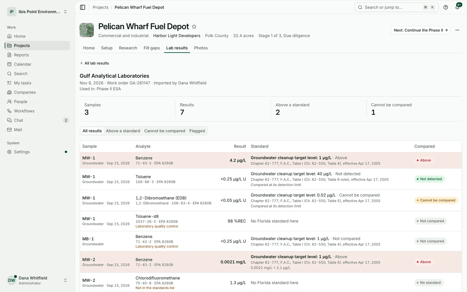
Phase I records
Phase I records and historical aerials, organised for you.
The records search, the county records to request and historical aerial photographs by year come together for the environmental professional to review and classify.
- Interviews, the questionnaire and the site visit in one record.
- Requests to counties and agencies tracked to their answer.
- The environmental professional and a second signer named on the report.
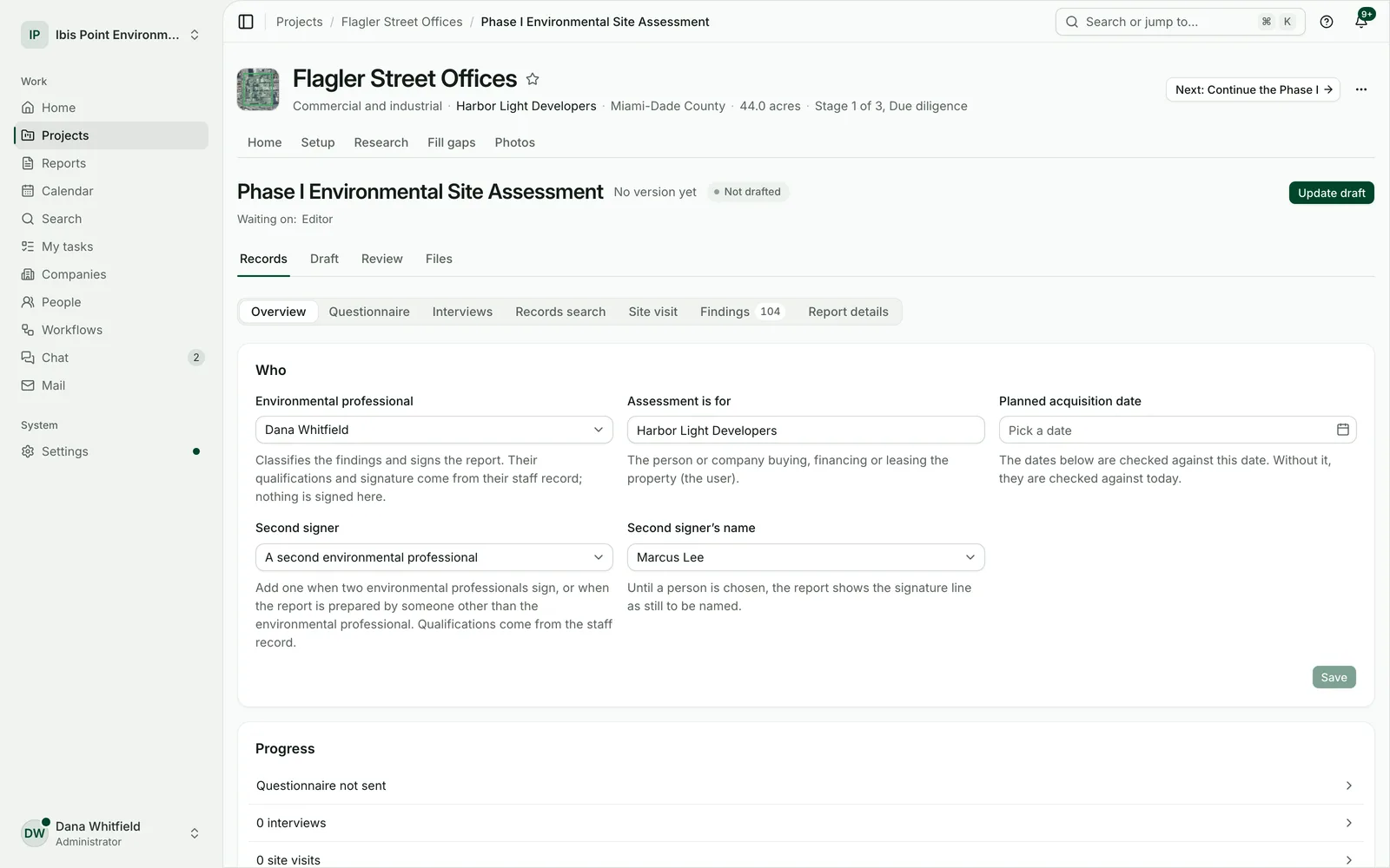
Connected apps
Works with the tools your firm already uses.
Connect once and keep working where you are. Owners and admins choose which apps each role can use.
- Save reports to SharePoint, Procore, Google Drive or OneDrive, and send them for signature with DocuSign.
- Bring survey points and forms in from ArcGIS Online and Survey123.
- Post updates to Slack, and link projects to BQE CORE, Deltek Vantagepoint or Ajera for billing.
Connects to your tools
Connect once at the firm. Each person signs in to their own account where it matters.
- Documents and signatures
- SharePoint · Procore · Google Drive · OneDrive · DocuSign
- Field and GIS
- ArcGIS Online · Survey123
- Calendar, email and chat
- Google Calendar · Outlook · Gmail · Slack
- Accounting
- BQE CORE · Deltek Vantagepoint · Ajera
Your clients’ projects, kept apart and kept safe
Consulting work is confidential. The workspace is built around that.
Walls between firms
Every request is checked against your firm and your role, and the database itself keeps each firm’s data apart.
Kept in the United States
The application, its database, files and encrypted backups stay on servers in the United States.
Encrypted
Every connection is encrypted, backups are encrypted, and connected-app keys are encrypted for each firm separately.
Files checked for viruses
Every uploaded file is checked before anyone can open or download it.
Two-step sign-in
Authenticator apps and passkeys on every plan. On Firm and Enterprise, owners can require it for everyone; Enterprise adds single sign-on.
A history nobody edits
Changes, approvals, exports and deletions are recorded in an activity log your firm can review.
See it on your own site
Start a 14-day free trial and draft your first report on a site you know. No card needed.