
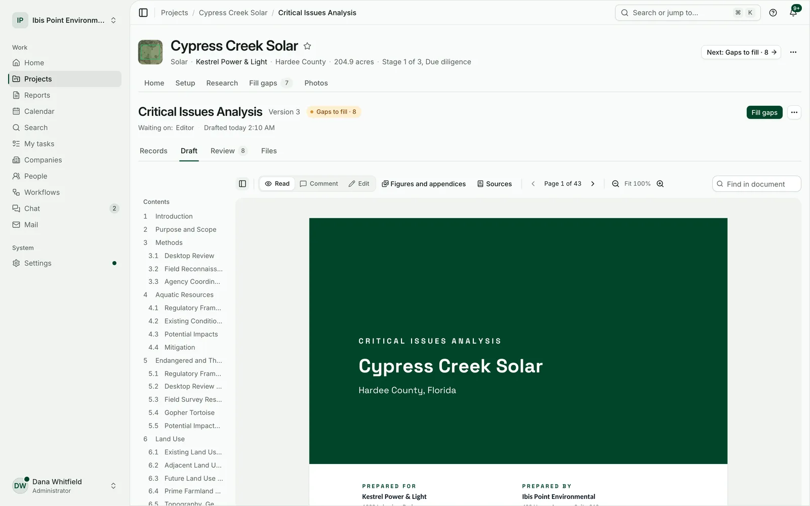
Your nextCritical Issues Analysisdrafted before you open it.
Wetlands, soils, flood zones, species, parcels. The public record for the site, written up with its citations. You review it and sign it.
14-day free trial with 2 report credits. No card needed.

4.3 Flood zones
Every value cited
Each figure names the agency source it came from.
Nothing invented
No fieldwork, signatures or risk scores it didn’t get from you.
Gaps shown, never hidden
A silent record is a question for your team, not “no impact”.
Days of desktop work, done before you sit down
01
Research that runs itself
Every source the chosen reports need is queried for the site and its study radius, and the answers stay on file with the project.
20report types and letters
02
Drafts you can defend
Each figure names its agency source. Desktop data is labelled as mapped data. Unknowns come back as questions, not as zero risk.
14project types, from solar to transmission
03
One project, every stage
Due diligence, field studies, then permitting and construction, all on the same site, research and survey record. Nothing re-entered.
3stages, one workspace
Everything a project needs, in one place
Due diligence is where it starts. The rest of the work lives here too, so nothing is re-entered and nothing gets lost between tools.
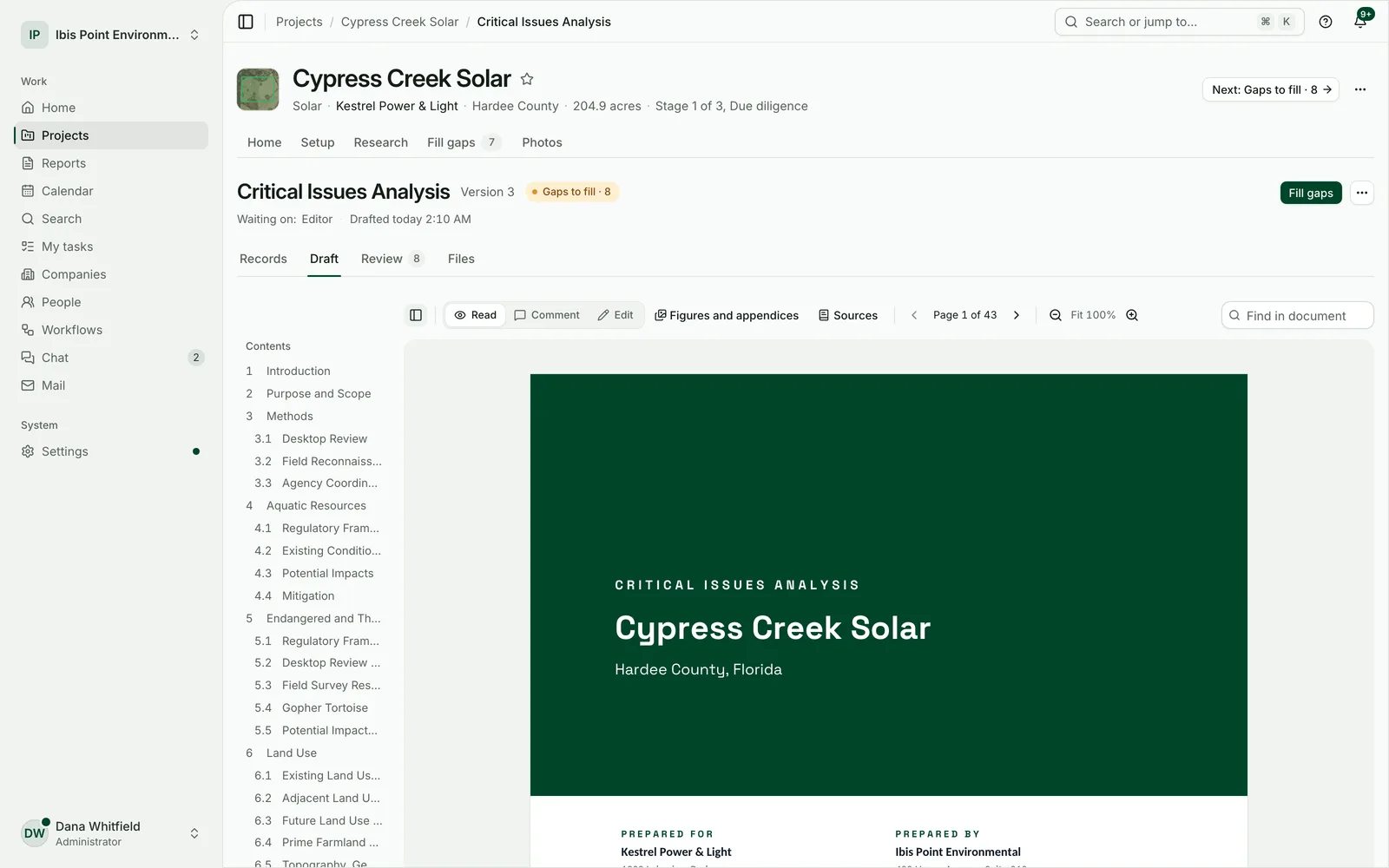
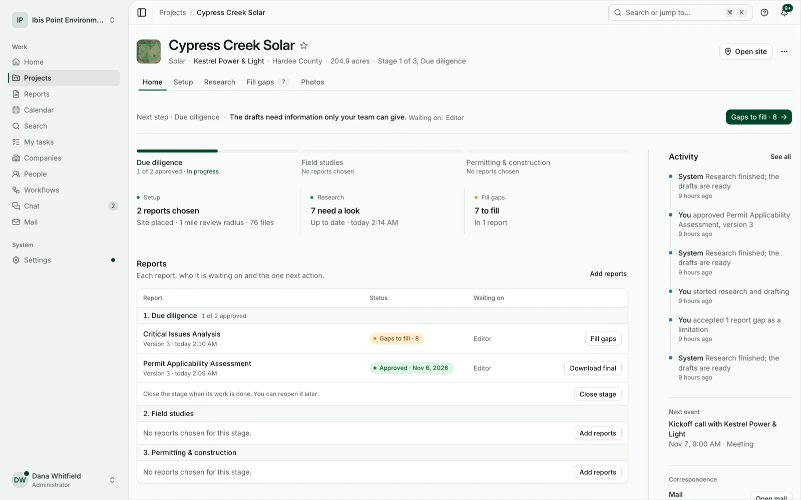
Pick the reports. The research and the first draft come back together.
Place the site once. Everything the chosen reports need is researched for the site and its study radius, and each draft comes back with its maps, tables, appendices and citations.
- Draw the boundary, upload a KML, KMZ, shapefile or GeoJSON, or pick parcels by address, number or owner.
- Every value names its source, and desktop data says it is mapped data.
- When project details change, the drafts that depend on them are marked for an update.
What a desktop CIA costs you today
The research behind a Critical Issues Analysis is public record. Most of the bill is the time it takes to gather and write it up.
Done by hand
$5,000+
what a desktop CIA bills for
- Days to weeks of desktop research
- Each source checked and transcribed by hand
- Figures drawn one at a time
- Every project starts from zero
With Environmental Nexus
$150
in credits on the Team plan
- Research runs while you work on something else
- Every value already cited to its source
- Maps, tables and appendices drafted with the text
- Your professional reviews, edits and signs
A CIA uses two report credits. On the Team plan ($750 a month, 10 credits) a credit is $75; on the Firm plan it is less.
See the plansFrom a boundary to a signed-off package
- Parcels picked from the map
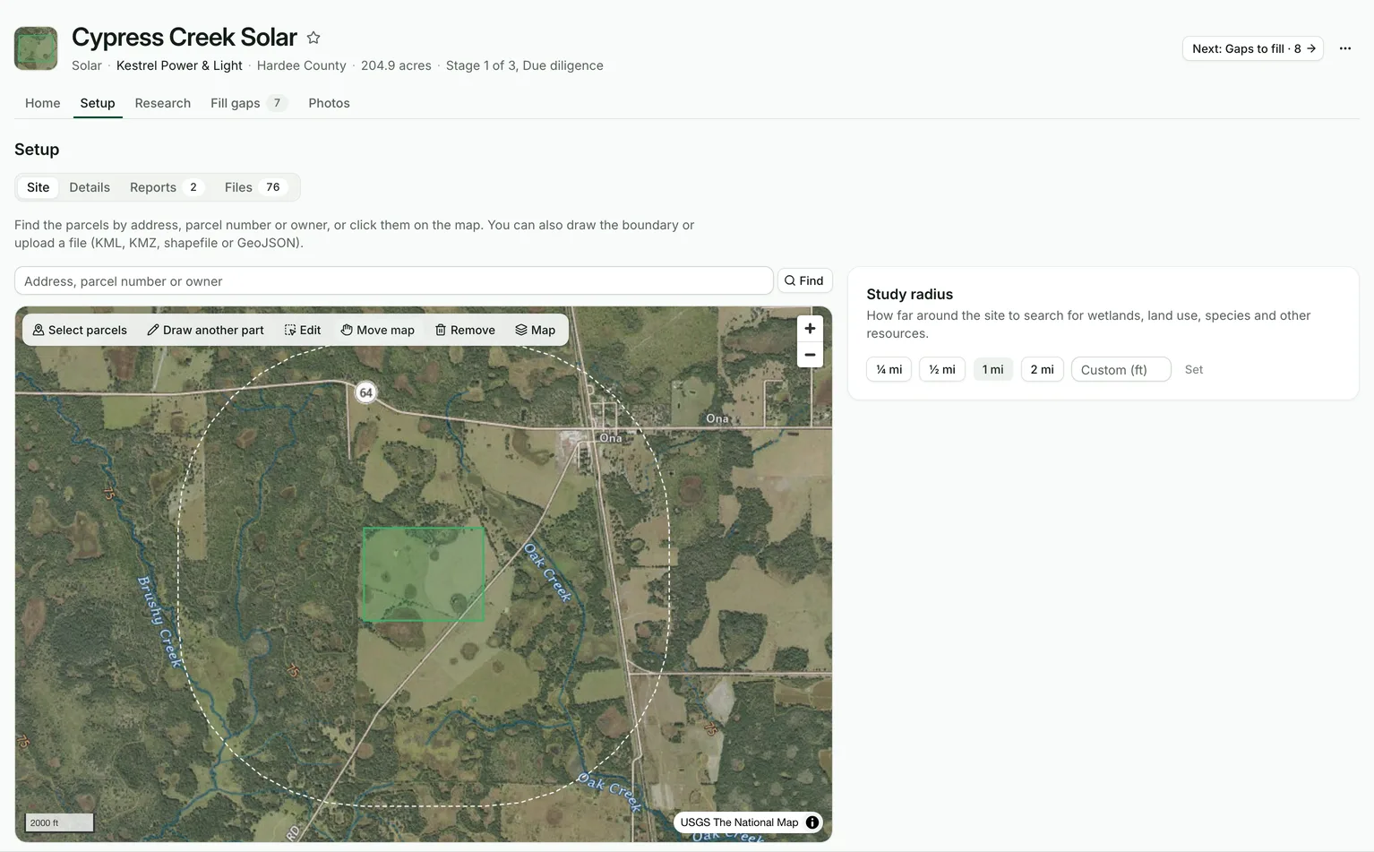
Step 1
Place the site
Draw it, upload a KML or shapefile, or pick the parcels. Lines take a centerline and a corridor.
- Every source, checked
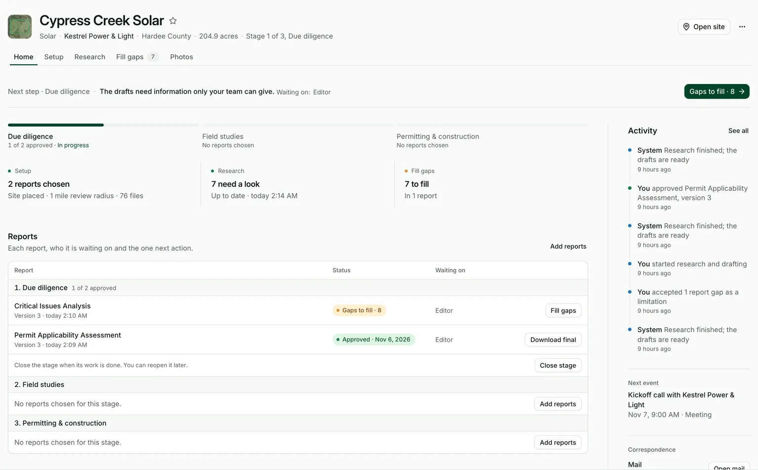
Step 2
Let the research run
Wetlands, soils, flood zones, species, land cover and more, queried for the site and kept on file.
- The crew’s findings, kept as theirs
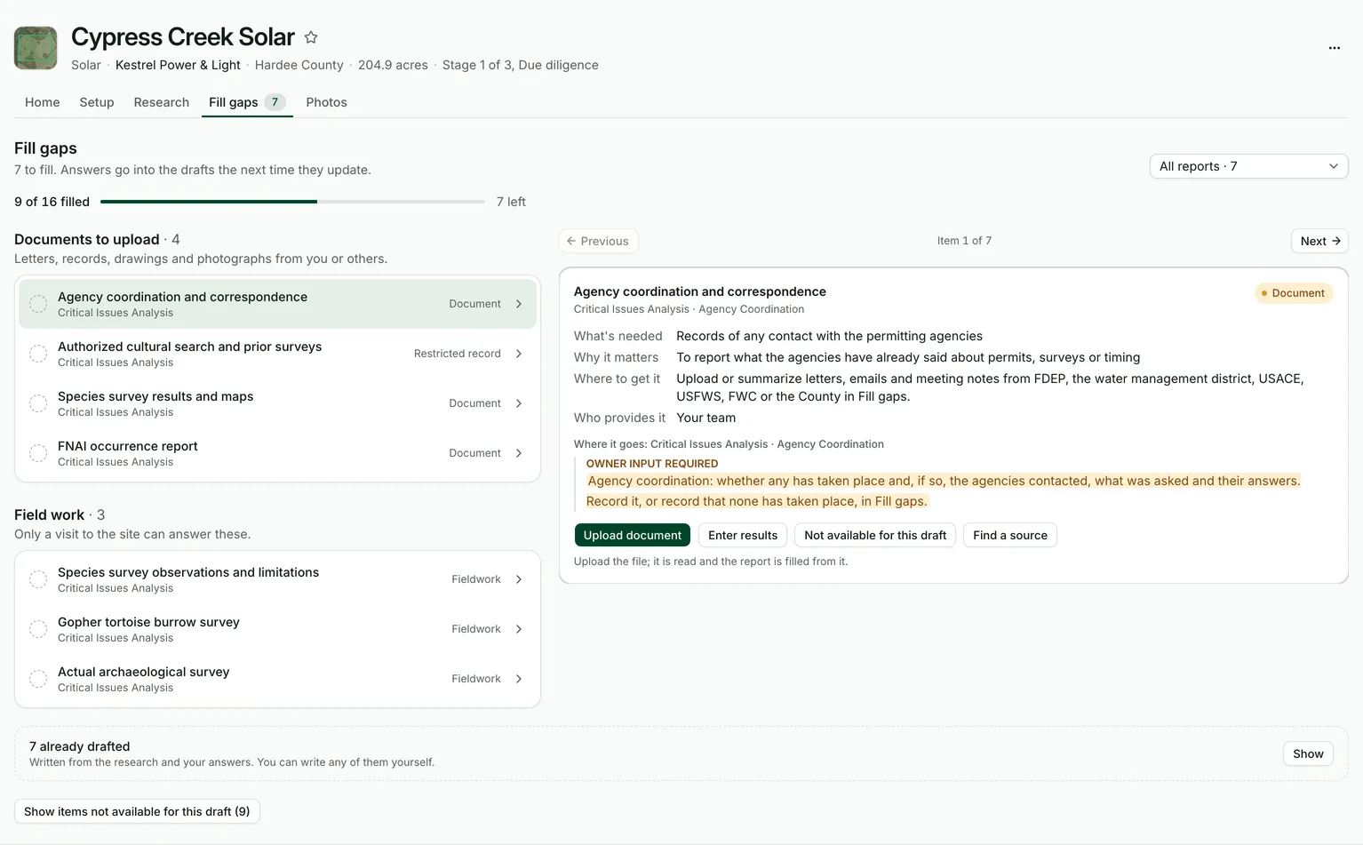
Step 3
Answer only what’s missing
What the public record can’t say comes back as a question for your team, one at a time.
- Ready to approve
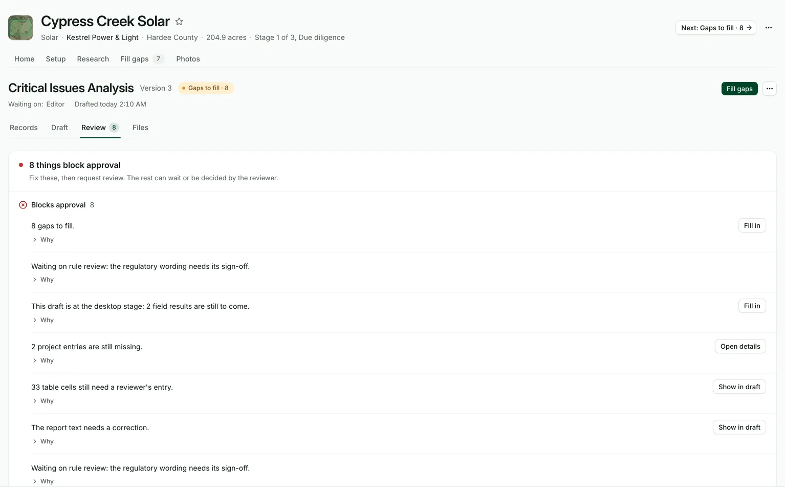
Step 4
Review, edit, approve
Read the draft beside its open items. Change any paragraph. Your wording carries into the next version.
- Download everything
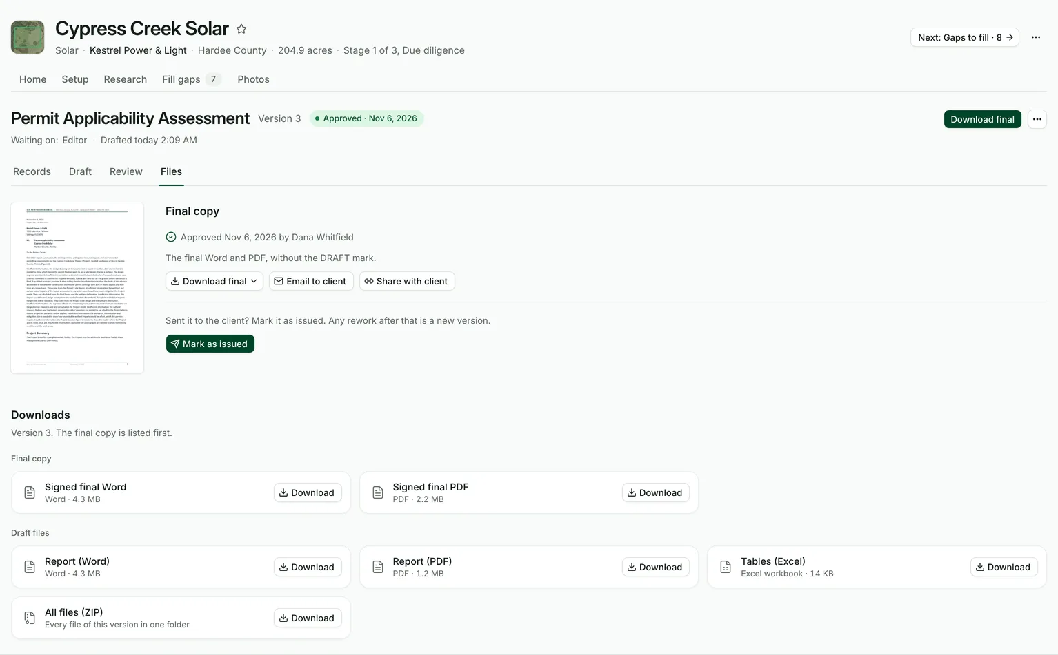
Step 5
Deliver the package
Word and PDF with maps and appendices, an Excel workbook of the tables for the screening, permit, alternatives, route, waters, spill and stormwater reports, and GIS data you can open in Google Earth, ArcGIS or QGIS. One file at a time or as a single ZIP.
The public record in. Client files out.
The research behind a site study is public record. You get it gathered, checked and written up, in the files your clients already expect.
What each study covers
Federal, state and county records for the site and its study radius, kept with the project and cited in the report.
- WetlandsMapped wetlands and their land cover class
- SoilsSoil map units, hydric soils and farmland
- Flood zonesFlood hazard areas and their acreage
- Land coverLand use on and around the site
- Listed speciesFederal and state lists for the site
- WatersWatersheds, streams and receiving waters
- Protected landsConservation and managed lands nearby
- ElevationTerrain and slope across the site
- GeologyFormations under the site
- ParcelsOwners, parcel numbers and acreage
What you deliver
Each report in Word and PDF with its maps, tables and appendices. The screening, permit, alternatives, route, waters, spill and stormwater reports add an Excel workbook, and the mapped reports add GIS data (KMZ and GeoPackage).
- Word
- Excel workbooks
- GIS data (KMZ, GeoPackage)
- Maps
- Field forms
- Package ZIP
Every study a project needs
Start with due diligence. Carry the same project through field studies and permitting without starting over.
Stage 1
Due diligence
- Critical Issues Analysis
- Permit Applicability Assessment
- Preliminary Alternatives Analysis
- Constraints Analysis
- Route Risk Assessment
- Route Optimization Study
- Phase I Environmental Site Assessment
- Phase II Environmental Site Assessment
- Site Assessment Report (FDEP, Rule 62-780.600)
Stage 2
Field studies
- Regulated Waters Assessment
- Regulated Waters and Listed Species Assessment
- Proposals and Letters
- Official field forms
- Survey123 and ArcGIS import
Stage 3
Permitting & construction
- Construction Stormwater Pollution Prevention Plan
- Industrial Stormwater Pollution Prevention Plan
- Spill Prevention, Control, and Countermeasure Plan
- Permit Application Package
- Natural Resource Memorandum and Erosion Control and Matting Plan
- Technical EIA Chapters (Hydrogeology and Traffic)
- Groundwater Monitoring Report
- Permit Compliance Report
Connects to your tools
Connect once at the firm. Each person signs in to their own account where it matters.
- Documents and signatures
- SharePoint · Procore · Google Drive · OneDrive · DocuSign
- Field and GIS
- ArcGIS Online · Survey123
- Calendar, email and chat
- Google Calendar · Outlook · Gmail · Slack
- Accounting
- BQE CORE · Deltek Vantagepoint · Ajera
Your clients’ projects, kept apart and kept safe
Consulting work is confidential. The workspace is built around that.
Walls between firms
Every request is checked against your firm and your role, and the database itself keeps each firm’s data apart.
Kept in the United States
The application, its database, files and encrypted backups stay on servers in the United States.
Encrypted
Every connection is encrypted, backups are encrypted, and connected-app keys are encrypted for each firm separately.
Files checked for viruses
Every uploaded file is checked before anyone can open or download it.
Two-step sign-in
Authenticator apps and passkeys on every plan. On Firm and Enterprise, owners can require it for everyone; Enterprise adds single sign-on.
A history nobody edits
Changes, approvals, exports and deletions are recorded in an activity log your firm can review.
Pay for the reports you send
Plans come with monthly report credits. A report uses credits once, at its first client export. Drafts, re-runs and new versions are free.
Team
For small consulting firms
$625
per month, billed annually
10 report credits a month Learn more
- 5 seats
- 10 report credits a month
- Extra credits $95 each
- 50 GB of storage
- Research for every report
- Field surveys and official forms
- GIS and survey file imports
Firm
RecommendedFor mid-size firms
$2,000
per month, billed annually
35 report credits a month Learn more
- 20 seats
- 35 report credits a month
- Extra credits $95 each
- 250 GB of storage
- Everything in Team
- Review steps and version compare
- Team dashboards and people reports
- Import projects from a spreadsheet
- Two-step sign-in required for everyone
- ArcGIS Online connection
- Custom rates and terms libraries
- Priority support
Enterprise
For utilities and large firms
from$40,000
a year
Credits pooled across the organization Learn more
- Unlimited seats
- Credits pooled across the organization
- 500 GB of storage
- Everything in Firm
- Single sign-on and user provisioning
- Sign-in only from your office networks
- Your own session length
- Custom roles
- Legal hold
- Security log streaming to your security tools
- Custom report branding and your own standard wording
Prices exclude any applicable taxes.
The questions consultants ask first
Something else on your mind? Book a demo and ask us directly.
That’s the point of the design. Environmental Nexus drafts; your professional reviews, edits and signs. Approving a draft inside the product is an internal step, not professional issuance, and the final report carries your firm’s name and signature.
See it drafted for a site you know
Light or dark, the workspace follows your preference. Try the switch.
14-day free trial with 2 report credits. No card needed.